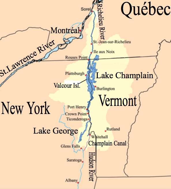
THE GEOGRAPHY OF LAKE CHAMPLAIN/LAKE GEORGE
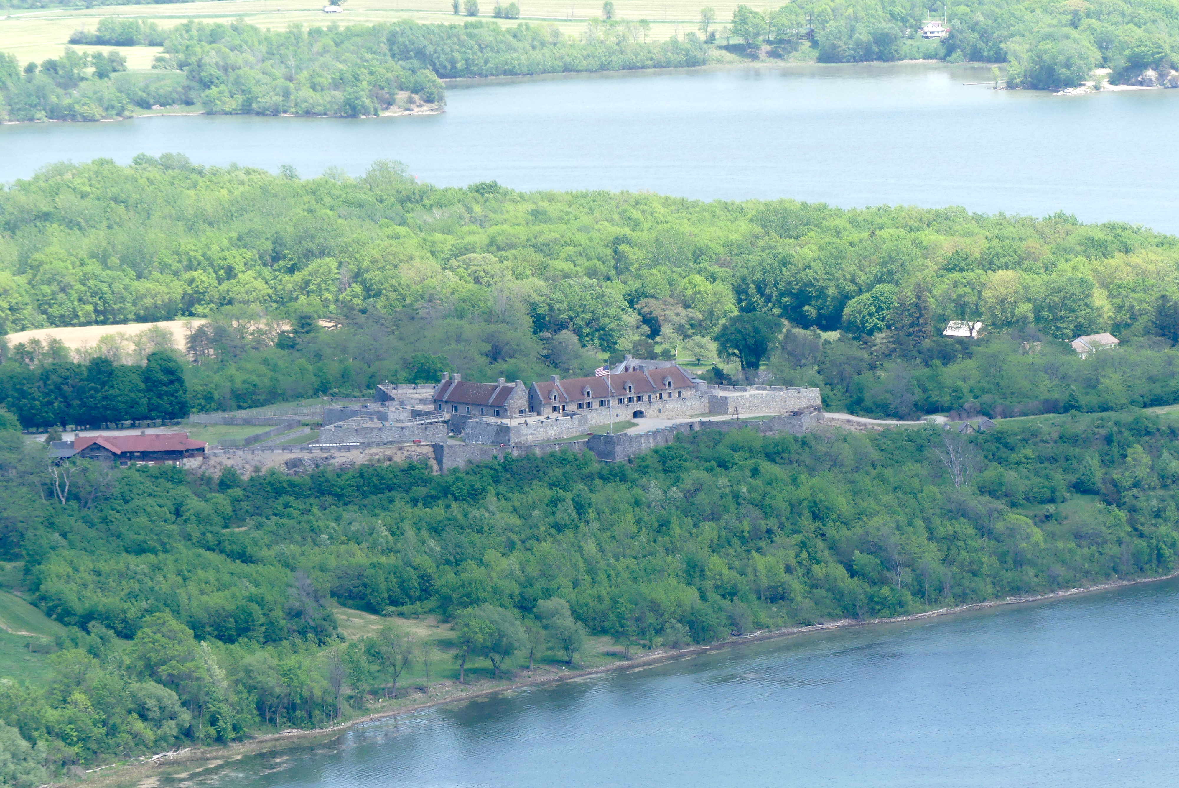
In my Fort William Henry post, I described the French and Indian War between France and England in North America. Fort Ticonderoga is a good point to open a discussion on the geography of the war. The major waterways in this part of far eastern New York are the Hudson River, the Richelieu River, Lake George and Lake Champlain. The Hudson River flows southward from near its source close to Lake Tear of the Clouds, north of Albany. Overland, from the Hudson fortification Fort Edwards on the Hudson River near Glens Falls to Fort William Henry on Lake George is only twenty miles. From Fort William Henry, one could travel north across Lake George, into and across Lake Champlain, whose outlet in the Richelieu River runs into the St Lawrence River. Water from Lake George and Lake Champlain as well as the Richelieu River runs northward. Thus, you could travel 350 of the 372 or so miles between New York City and Canada by water back then. The French could sail an army to New York City as easily as the English could launch an attack by water on Canada. But the French would have been happy just to take Albany, which was the capital of New York colony. To keep the British away from this waterway into the heart of Quebec, the French built Fort Carillon (eventually to be renamed as Fort Ticonderoga) and other fortifications around Lake Champlain. Meanwhile, the British focused on the south shore of Lake George.
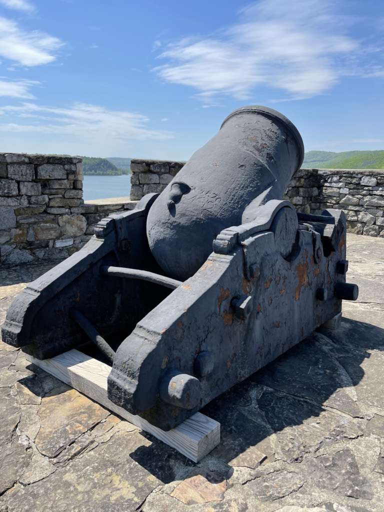
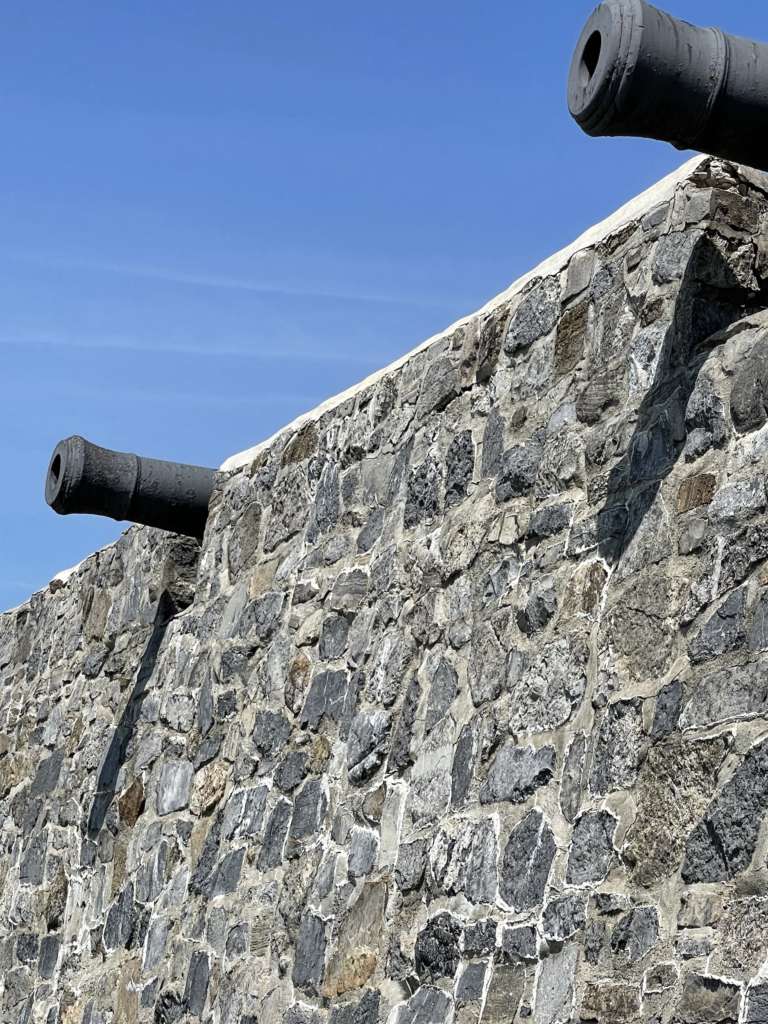
The engineering genius behind Fort Carillon was a French officer named Michel Chartier-de-Lotbiniere. In addition to the fort, itself, he built extensive fortifications as well as a sawmill, a rock quarry, and an ammo dump hewn into a vault of solid rock..
A strategic overlook half of a mile southwest of Carillon (Ticonderoga) was Mount Defiance (853 feet high.) It would play prominent roles over the battles fought at Ticonderoga in the future.

There are several different tours, including one at night where a representation of a bombardment is recreated. There are statis displays featuring a typical barracks room, cooking as it was then at the time, etc. It would be useful, but perhaps not cost effective, to hire a dozen or more additional actors to dress as British, French, colonial and Huron soldiers/warriors. Maybe set up a facsimile Huron camp where several Native Americans can represent their ancestor’s involvement in the conflict?
Also, random firing of a canon might generate interest as well. Or, a small cinema with a video presentation of life at the Fort, the French and Indians War, etc.
The gift shop at Ticonderoga is one of the best and well stocked that I’ve seen at a park or tourist attraction. It has excellent books and other items as well as a cafeteria. If you decide to include Mount Defiance and Crown Point in your itinerary, you’ll have more than enough to fill your day.
| Description | This is a map showing the Lake Champlain-Richelieu River watershed made using USGS, Census Bureau and Digital Chart of the World data. |
| Data | 26 July 2006 |
| Source | Author’s work |
| Author | Kmusser |
| Other versions | Deriviative works of this file: Champlainmap fr.svg Champlainmap.svg |
FORT TICONDEROGA TIMELINE
The following information is provided to the public by FT Ticonderoga.
The Lake Champlain Valley has long been at the crossroads of nations and peoples. The name Ticonderoga is a corruption of an Iroquoian word meaning a “place between two waters,” an acknowledgement of its location which has made it central to the history of North America.
1609: A battle is fought on the shore o9f Lake Champlain at Ticonderoga between Mohawks and Algonquian speaking warriors from Canada. With the latter are three Frenchmen, making this the first combat between the Europeans and Native Americans in the Champlain Valley.
1754: [For the last 145 years] war-fare continues between Native and European powers. Ticonderoga’s position puts it in the path of fighting men from many nations. French soldiers of the Carignan-Salières Regiment traverse the peninsula in 1666 to strike at the Mohawk. In 1690, English and native forces pass through to attack Canada, perpetrating a bloody escalation of colonial warfare.
1755: French and British regular soldiers are transported to North America fueling a colonial conflict begun in 1754. Following a French defeat at the Battle of Lake George in September, Michel Chartier-de-Lotbiniere begins to plan a fortification on the Ticonderoga peninsula to secure the strategic water route to Canada. It is named Fort Carillon.
1757: The French appeal to Native nations to aid them in their war against the English. Nearly 2,000 warriors from as far away as the Great Plains respond, the largest Native American military force of the 18th century. Assembling at Fort Carillon they launch an attack on Fort William Henry in August. The attack is a success, but confusion and misunderstandings between French and Native expectations and assumptions cause their partnership to collapse.
1758: General James Abercrombie launches what at the time was the largest military force ever assembled in North America to assault Fort Carillon. On July 8, outnumbered and lacking substantial Native allies, the French under the Marguis de Montcalm deliver a shocking defeat to the British from behind hastily built defenders on the rising ground about half a mile [west of Ticonderoga.] Nearly 2,000 British and American casualties make it the bloodiest battle on the continent until the 1860s.
1759: With Quebec threatened by a British attack, Fort Carillon is undermanned as another British army commanded by Jeffery Amherst approaches. Outnumbered, the French blow up the powder magazine as they withdraw. Finally in English hands, Fort Carillon is renamed Fort Ticonderoga.
1760: Cabada surrenders to the British in the fall of of 1760, effectively ending the French and Indian War. From the end of hostilities until the opening of the American Revolution in 1775, British forces continuously garrison Fort Ticonderoga with small detachments. This period represents the longest the position was held by one power in its history.
1775: Early in the morning of May 10, 1775, less than a month after the commencement of hostilities between Britain and the American colonists, the small British garrison of the fort is surprised and captured. A force of colonials under the joint command on Ethan Allen and Benedict Arnold delivers America a major moral and material victory at little cost.
1776: Ticonderoga had served as a staging point for the American invasion of Canada, which aster initial success collapses in early 1776. The shattered army retires to Ticonderoga to consolidate, retrain, and prepare land and naval defenses. When the British pursue, they are delayed at the Battle of Valor Island by the American fleet. When the British test the lines at Ticonderoga on October 28th they find well-prepared American troops blocking their path and turn back.
1777: General John Burgoyne launches a new British offensive, anticipating a major siege of Ticonderoga on his way to Albany. As the British approach the outnumbered Americans under General Arthur St. Clair evacuate Ticonderoga on July 6th. Until November, Ticonderoga remains occupied by British and German soldiers withstanding an American surprise attack in September, before it is evacuated following word of Burgoyne’s surrender at Saratoga. A short reoccupationof Ticonderoga in 1781 is the last military activity on the site.
CITATIONS
Laramie, Michael G. Colonial Forts of the Champlain and Hudson Valleys, History Press, 2020
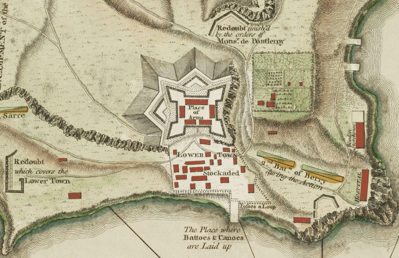
Featured print (Map of Fort Ticongeroga) by Thomas Jeffreys (1719-1771.) Based on the year of the author’s/artist’s death, plus 100 years, this image falls in the area of public domain. Image resides in the Library and Archive of Quebec.